

- Compatible with the PIX4D Suite
- Photogrammetry flight modes available in FreeFlight 7 and OpenFlight
- Single-click flight plan creation


Renting Drones
![]()

Visita nuestras redes sociales
![]()
![]()
![]()

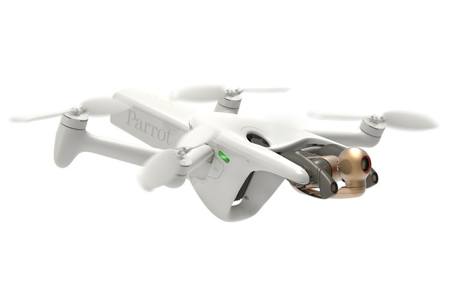
Nuevo
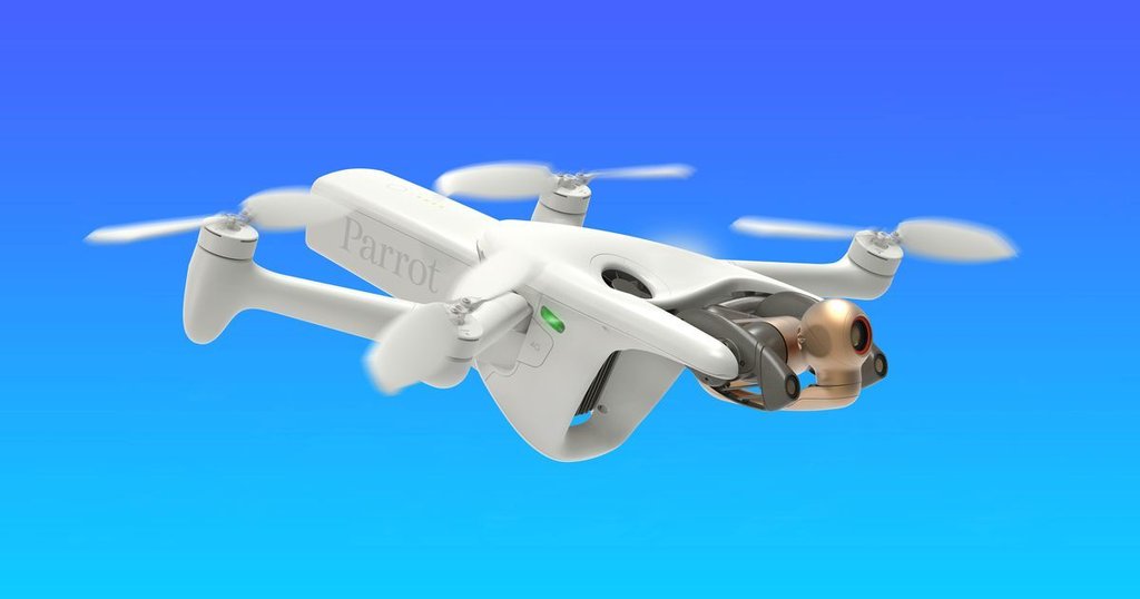
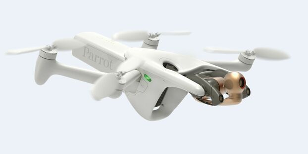
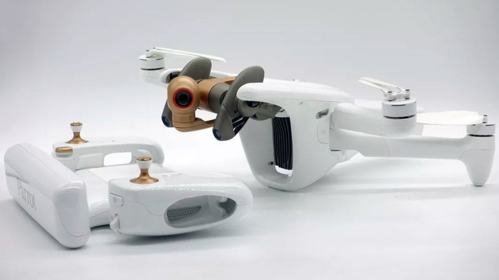
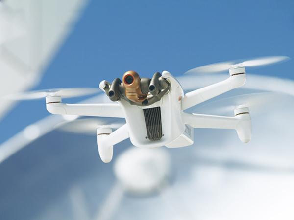
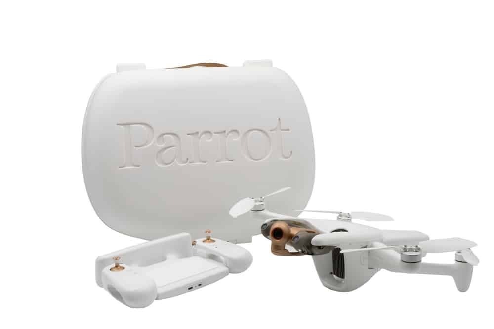
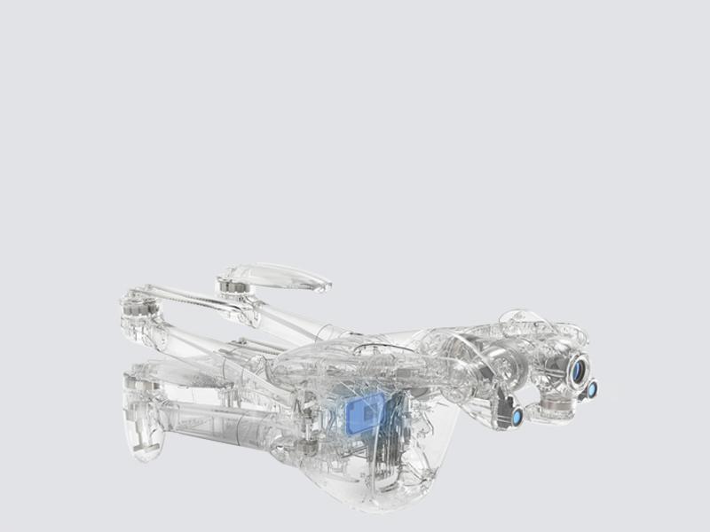
PARROT ANAFI Ai
N.º de producto: ANAFI AiNo disponible en estos momentos
Notificar sobre disponibilidad
5.499,00 €
Photogrammetry
Key features:
- 48 MP stills at 1fps: twice as fast as competitors
- Survey-grade accuracy: 0.46cm/px GSD at 30m (100ft)
- In-flight 4G transfer to PIX4Dcloud
Aerial drone imagery is changing the way professionals carry out inspections and surveying. Photogrammetry techniques are used to process images collected by UAVs to create 2D and 3D models. These digital twins allow our customers to plan maintenance.
4G gives an unprecedented robustness to the drone data link. Our customers can operate their drone in large areas, near metallic structures, buildings, without losing the connection.
Designed for inspection and mapping
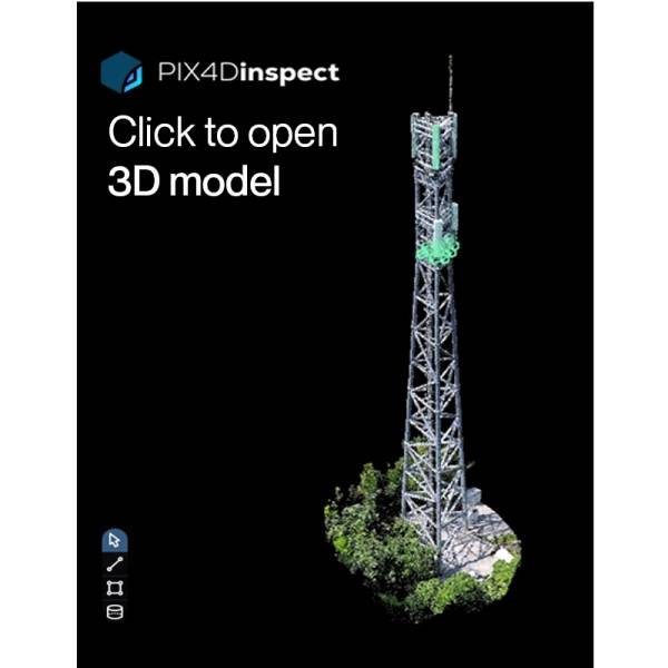
When Ai meets visual inspection
By combining the artificial intelligence of our drone with that of PIX4Dinspect online platform, our users will perform inspections faster and more efficiently than ever. Machine learning algorithms recognize antennas on cell towers, and extract their dimensions, height, downtilt, azimuth and plumb.
Click the images below to explore demo 3D models.

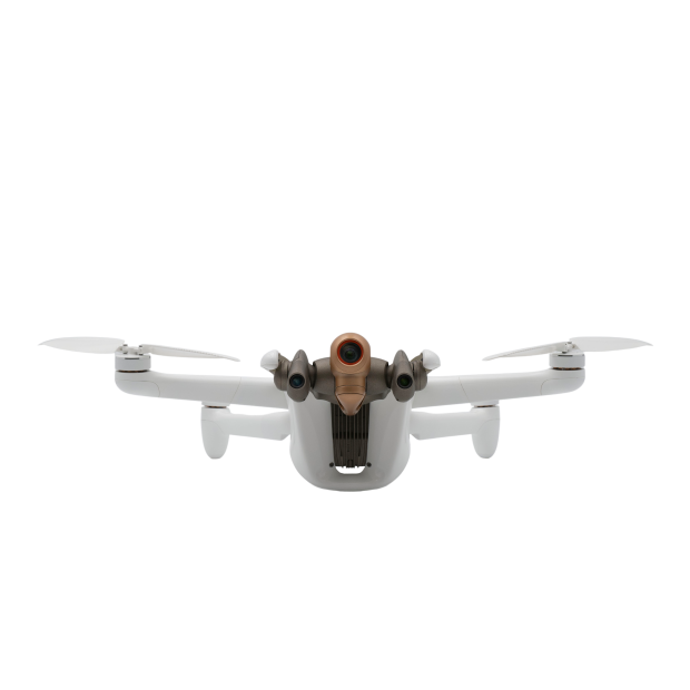
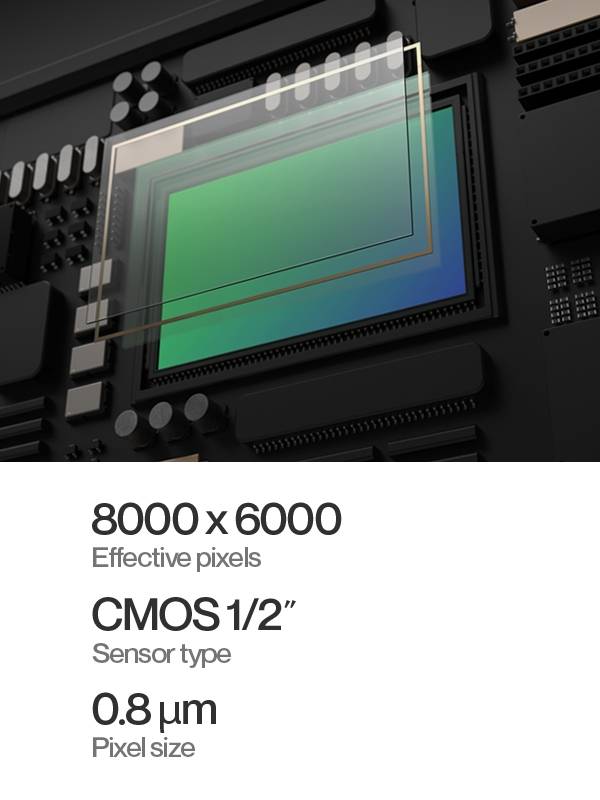
Best in-class sensor
ANAFI Ai embeds a 48 MP 1/2'' CMOS sensor. Equipped with a Quad Bayer color filter pattern, specifically suited for inspection and photogrammetry. Our sensor allows to capture highly detailed images with a wide dynamic range.
High resolution stills
ANAFI Ai generates 48 MP still photos, so customers can capture all details in high definition and generate high density point clouds.
Great sharpness
Inspection missions require the ability to identify minute details, such as serial numbers, connectors, rust spots, and incipient cracks.
Wide dynamic range
10 stops of dynamic range in Standard mode, 14 stops in HDR mode. Optimal gradation of your images is essential to generate consistent point clouds and high quality 2D or 3D reconstructions.
55% more details than 1’’ sensors
The 1/2'' Quad Bayer 48 MP sensor outperforms in sharpness the 1'' 20 MP sensors embedded in several professional drones.
The following images taken from a roof inspection mission taken at the same altitude illustrate that well.

Ideal for inspection
The ANAFI Ai gimbal embeds a 6-axis hybrid (mechanical + electronic) stabilization system, which compensates the flight vibrations and guarantees sharp images.
ANAFI Ai’s camera has a controllable range of -90° to +90°, making it the ideal aerial tool for inspecting the underside of a bridge deck.
±90° CONTROLLABLE TILT
Survey-grade accuracy
ANAFI Ai allows users to reach a 0.46 cm/px GSD at 30 m, meaning a relative accuracy in planimetry to within 0.92 cm.
For comparison, at the same altitude, the DJI Phantom 4 Pro v2 only delivers a GSD of 0.82 cm/px. In other words, ANAFI Ai can map the same target while flying more than 1.5 times higher than a Phantom, with an equivalent level of detail.
| ANAFI Ai | Phantom 4 Pro v2 | |
| Image width (px) | 8000 | 5472 |
| Image height (px) | 6000 | 3648 |
| Sensor width (mm) | 6.4 | 13.2 |
| Sensor height (mm) | 4.9 | 8.8 |
| GSD (cm/px) at 30m | 0.46 | 0.82 |
Harness the power of AI and 4G
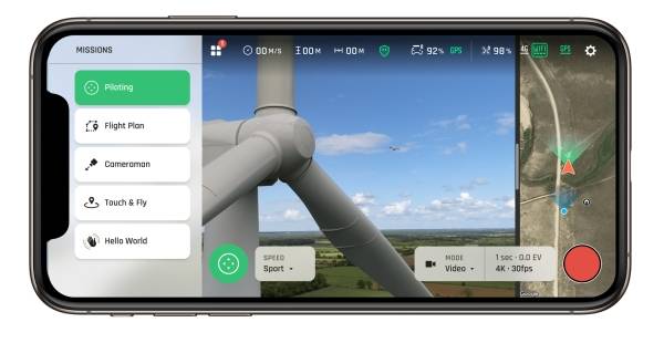
One app. Any flight plan.
Launch all your surveying, inspection and photogrammetry missions all from FreeFlight 7.
Photogrammetry flight modes available in FreeFlight 7.
Grid, double-grid and circular missions from the PIX4Dcapture flight planning app are now integrated into the ANAFI Ai flight app.

Single-click flight plan creation
A click on FreeFlight 3D interactive map is all it takes to generate a quick building scanning. Artificial Intelligence automatically defines optimum flight parameters and trajectory. The 48 MP images precisely geotagged by ANAFI Ai sensors (IMU, GNSS & Time of Flight) allow an accurate 3D reconstruction.
FreeFlight 7’s mapping background comes from ArcGIS. 3D buildings representation is based on OpenStreetMap data, which covers cities all over the world.

Automatic flight plan created with a single click on 3D land registry
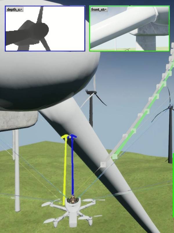
Perception systems ensure the safety of the flight plan: users don't need to worry about obstacles. ANAFI Ai avoids them autonomously.
Autonomous flight
ANAFI Ai’s omnidirectional sensing system, based on stereoscopic vision, is automatically oriented in the direction of movement.


The drone detects obstacles located at 30 m (100 ft). While performing a flight plan, Artificial Intelligence technology continuously builds and updates an occupancy grid. It represents the drone’s environment in voxels.
Algorithms determine the best trajectory to avoid obstacles, while the drone stays focused on its objective: the flight mission.

4G connectivity
ANAFI Ai is the first commercial micro-drone equipped with a 4G module. It covers more than 98% of the frequencies used worldwide.

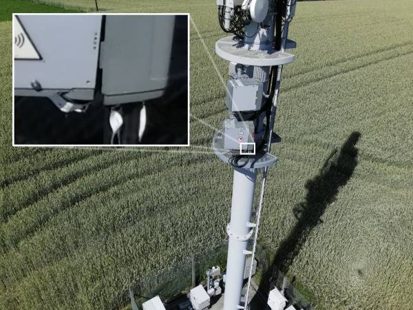
Inspection of high-voltage power lines.
Captured with ANAFI Ai, processed with Pix4Dmatic. Scene size: 4060 x 60 x 70 m / 13,320 x 200 x 230 ft. Number of images: 2,172.
GSD: 1.3 cm/px. Altitude: 90 m / 295 ft. Front / side overlap: 90% / 65%.
The drone seamlessly switches from Wi-Fi to 4G, and vice versa, favoring the strongest connection. This guarantees:
- Ability to conduct BVLOS flight operations
- Stable connection, even when flying in environments cluttered with obstacles and buildings
- Safe flights in interference-rich environments
- 1080p 30 fps live streaming
- Direct images upload to cloud servers

Flight time optimization
Achieve significant time efficiency thanks to ANAFI Ai’s imaging specifications:
- The 48 MP allows the drone to fly more than 1.5 times higher than drones with 1’’ 20 MP sensors, while reaching the same GSD. Higher altitude and faster mission go hand in hand.
- Photo capture at 1 fps: ANAFI Ai shoots twice faster than Autel EVO 2 and DJI Phantom 4 Pro v2.

In-flight 4G transfer to PIX4Dcloud
In the process of creating a digital twin from UAV aerial imagery, file transfer and photo processing are two time-consuming tasks.
ANAFI Ai helps our customers speed up their workflow and:
- Transfer images to secure servers during the flight, leveraging the drone’s 4G connectivity
- Immediately start computing objects when flight ends: orthomosaic maps, point clouds, elevation models and textured mesh
- Easily share survey-grade 2D maps and 3D models with collaborators and clients

Compatible with the PIX4D Suite
A unique suite of mobile, desktop and cloud Photogrammetry applications, consisting of:

PIX4Dcloud
Online professional image processing
PIX4Dmapper
Advanced data processing software
PIX4Dscan
Flight planning for telecom tower inspections
PIX4Dinspect
Industrial inspection automation and asset management
PIX4Dreact
Offline 2D mapping for emergency response and public safety
Photogrammetry or LIDAR?
Why you should choose Photogrammetry for surveying and inspections
Aside from its affordability and ease of use, aerial photogrammetry is your best choice when a visual interpretation of data is needed.

Photogrammetry indeed:
- Provides multiple renderings: orthomosaic maps, colored point clouds, textured mesh
- Generates higher density point clouds, each containing a significant amount of information (elevation, texture, color)
- Outperforms LIDAR in the accuracy of 2D and 3D renderings, which are photorealistic – LIDAR does not provide a high level of contextual detail
LIDAR cons
- Costs up to 100 times more than a UAV with an RGB sensor
- Complexity of data processing and potential errors of interpretation
- Adding color information is possible, but it makes the process even more complex
- Reserved for specific use cases and situations, LIDAR generates only point clouds
Connectivity
Key Features
- Always connected, worldwide continuous connection to the Internet
- Seamless Wi-Fi to 4G switch: flies Beyond Visual Line of Sight
- Worldwide LTE compatibility
- Real time streaming with 12 Mbps video bitrate / Low latency 1080p streaming
- In-flight cloud file transfer
4G
ANAFI Ai integrates a 4G radio module (in addition to the Wi-Fi radio) allowing to transmit a video in 1080p with a very low latency (300 ms) without range limit and everywhere in the world.

Compatibility
The ANAFI Ai 4G module supports more than 28 frequency bands, covering more than 98% of the frequencies deployed around the world.
Automatic network switch
The quality and capacity of the 4G and Wi-Fi networks are measured every 100 ms to adapt the streaming to the network conditions. Combined with the routing algorithms, the connection between the drone and its controller is maintained even when the Wi-Fi is strongly disrupted. Thus, when the effective throughput (goodput) of Wi-Fi is lower than 1.5 MBps, the system automatically switches to 4G.
To limit mobile data consumption when the pilot is within range of the drone's Wi-Fi network, the 4G to Wi-Fi transition is also automatically performed, without video stream cut.
The implemented video stream optimization algorithms:
“Congestion control 4G”
The congestion control algorithm allows to:
- Measure packet loss over the entire network loop
- Measure the latency (Round Trip Time)
- Adapt the throughput according to these two parameters
The final objective of the algorithm is to maximize the available throughput while maintaining the lowest possible latency. This algorithm is implemented on each of the interfaces available on the drone, each one having its own parameters optimized according to the network. Thanks to the information provided by this algorithm, the link supervisor decides on the routing and the active interface.
“Remote control drone connection in 4G”
ANAFI Ai connects to the 4G remote control in less than 30 seconds when the drone is not in Wi-Fi range, and in less than 15 seconds when the drone is in Wi-Fi range.
- Discovery and initiation of the connection based on the VOIP SIP protocol
- Use of a relay server to establish the connection on secured networks
Video stream performances
- Latency: 300 ms
- Security: Video and controls secured by SRTP/DTLS in accordance to webRTC
- Antennas: 28 LTE bands between 700 Mhz and 2.6 Ghz
Wi-Fi
Key features
- Max range: 4 km (CE), 9 km (FCC) with the Parrot Skycontroller 4
- Gain in 2.4 ANAFI Ai: 3.5 dBi +/-1.5 dB (MAVIC Air 2: 1.5dBi +2/-6 dB)
- Gain in 5 ANAFI Ai: 3.5 dBi +/-1 dB, (MAVIC Air 2: 1.5 dBi +3/-7 dB)
"Omni-directional transmission system“
ANAFI Ai has 4 directional antennas with reflector (gain: 2.5 dBi/antenna). The drone determines the best antenna pair depending on its orientation and position in relation to the pilot's position.
With a recombined gain of 3.5 +/-1.5 dBi in the horizontal plane of the drone, the radio gain of ANAFI Ai is strong homogeneous.
The downward radiation of the antennas has been improved by +4 dB compared to ANAFI.
High Power Radio Front-End Design
The radio front end allows to push the power to the maximum at the foot of the antenna with a very good level of linearity and sensitivity (-94 dBm at 6.5 Mbs), allowing to reach the maximum power of the FCC limit.
Robust Wi-Fi Connection
Parameters 802.11:
A subset of protocol parameters was selected to optimize performance in the drone use cases: relatively low throughput, low latency, variability in reception levels due to drone speed, long range, presence of interferers. These parameters include aggregation, number of retries, MiMo technology (STBC), management frame datarate, and disconnection conditions.
Flow adaptation and monitoring
ANAFI Ai continuously monitors its connection status at 4 Hz and can detect the presence of interference. This allows to dynamically optimize the throughput and the size of the transmitted packets. It also alerts the pilot if he is in a particularly interference-laden environment, or if he is close to losing the signal.
“Smart interference avoidance system“
ANAFI Ai has a channel avoidance algorithm (dual band 2.4 GHz and 5 GHz) in case of interference detection.
Bandwidth reduction
At the limit of its range and if the conditions allow it, ANAFI Ai can switch to 10 MHz bandwidth to improve its sensitivity by 3 dB and gain 40% in range.
Radio Performances
| Physical layer: | OFDM (Wi-Fi) |
| List of channels: | |
| 2.4 Ghz EU | 2.412 to 2.462 Ghz (5 Mhz steps) |
| 2.4 Ghz US | 2.412 to 2.462 Ghz (5 Mhz steps) |
| 5 Ghz EU | 5.745 to 5.825 Ghz (20 Mhz steps) |
| 5 Ghz US | 5.745 to 5.825 Ghz (20 Mhz steps) |
| Average at 2.4 Ghz | 0 dB (ref) |
| Radiance variability (2.4 Ghz | -1 dB |
| Average at 5 Ghz | 0 dB (ref) |
| Radiance variability (5 Ghz | -1 dB |
| Sensitivity (antenna bottom) | -95 dBm |
| Overlapped | 0 dB (ref) |
| ACR (+25 Mhz) | 0 dB (ref) |
Video streaming
Key features
- H264 encoding with RTSP and RTP transmission protocols
- Internet Stream Sharing with RTMP protocol from the 4G phone on the remote control
- Local Stream Sharing with HDMI video output on the remote control
- Multi-camera: ability to access stereo, vertical and disparity map camera streams, in addition to the front camera
- The video stream is compatible with RTP players, like VLC or mplayer
- 1080p at 30 fps, up to 8 Mbit/s
- Compatible with the H264 and MPEG standards
- Reduced latency (< 300 ms glass-to-glass)
Stream performance
| Resolution | up to 1080p |
| Frame-rate | up to 30 fps |
| Bit rate | up to 8 Mbit/s |
| Video encoding | H.264/AVC |
| Protocol | RTP streaming with RTSP session management |
| Latency | 300 ms |
The implemented video stream optimization algorithms:
Parrot Gen4 Streaming (4th generation)
“Error concealment”
This algorithm reduces the visual impact of losses on the network and it enables the interoperability of all decoders, while ensuring a syntactically complete stream: missing images parts are reconstructed as skipped portions, identical to those of the reference image.
The glitches are therefore contained within zones impacted by losses, and do not spread to the entire image.
The following graphs illustrate the rate of success in decoding macroblocks, for a network loss rate of 5% - with and without ANAFI Ai’s advanced streaming functions. The algorithm ensures a correct decoding for 75% of the macroblocks. Those enable the user to carry on with his mission without screen freeze or streaming loss.

Overall macroblocs NO CORRECTION

Overall macroblocs CORRECTED
“Congestion control”
The algorithm estimates the Wi-Fi and radio environment to anticipate and avoid packet loss and congestion on the network, thus helping to reduce latency.
The algorithm is based on an estimate of the link capacity calculated from the data rate and the error rate at the physical level; it then acts on the network encoding and encapsulation parameters.
Metadata
Metadata are transmitted with the video stream. They notably contain drone telemetry elements (position, altitude, speed, battery level, etc.) and video metrics (angle of the camera, exposure value, field of view, etc.).
The synchronization of the images and the metadata open functions as precise map positioning, flight instrument tracing within the HUD or augmented reality elements inclusion.
The inclusion of metadata is using standard methods (RTP header extension); the format of the data, defined by Parrot, is public: it is available within ANAFI Ai’s SDK.
ANAFI Ai Technical documentation

A naturalist remark
In the animal kingdom, there is no known species that has optical sensors distributed around its body.
No insect, bird, fish, or mammal has developed a “visual perception system” of sensors, despite each species needing to detect obstacles or predators in all directions in order to survive.

Natural evolution has led to the most widespread and efficient solution. For example:
- mobile heads that can be oriented on 3 axes: left/right (yaw), up/down (pitch), and also to a lesser extent with respect to the horizon (roll);
- this integrates a unique pair of sensors adapted to the animal's behavior, and installed on a vertical plane of the face for tree-dwelling primates from which we descend, or directed more laterally for equids for example;
- the pair of sensors are generally mobile on 2 axes: left/right (yaw axis) and up/down (pitch axis).
This visual perception is created of a pair of sensors (the eyes) mobile on 5 free axes (the movements of the head and eyes in their orbits).

In biology, we also see this in the evolution of the optic nerve. For most species, the optic nerve is the largest of its kind; it transmits large amounts of information across the body to its cerebral support. It is also a very short nerve made up of a bundle of cerebral fibers. When we apply this to a drone, the link (the bus) between the sensor and the processor requires an essential exchange of information, which implies optimizing the length of the bus.
Anatomically, the head of some species is often detached from the rest of the body. Some flying species (insects, birds, mammals) have their head located at the front of its frame, extending the view of the rest of the body - especially its wings. The placement of its head also allows its eyes to be positioned in such a way as to have an excellent field of view in all directions, and turning the head allows most flying species to see precisely behind them.
Thus, from this system of visual perception and from this cerebral support emerges the cognitive functions, in this case the perceptive and conceptual functions.
It is from this system of visual perception and cerebral support emerges the cognitive functions - in this case the perceptive and conceptual functions.
With this is in mind, Parrot has designed the ANAFI Ai obstacle avoidance system.
Camera
Key Features
- 48 MP sensor
- 4K video at 60 fps
- HDR10 – HDR8
- 14 EV dynamic range
- 6x zoom: 1 cm details at 75 m (240 ft)
48 MP sensor
ANAFI Ai’s sensor supports a high megapixel count for finely detailed aerial shots.
It uses a Quad Bayer color filter array, where groups of 4 adjacent pixels come in the same color. Real-time HDR capture can be obtained in both photo and video modes, by adding the signals from the four adjacent pixels.
Its dynamic range is 4 times greater than conventional sensors, featuring a regular Bayer matrix. Even difficult scenes can be captured with minimal highlight blowout or loss of detail in shadows.
Lens design

The ANAFI Ai lens is specifically designed for Parrot. It integrates 6 aspherical elements and has been optimized for low optical flare.
This lens gives a 68° HFoV in Standard video mode, and a 64.6° HFoV in Standard photo mode.
Video modes
Description of modes
ANAFI Ai shoots smooth 4K 60 fps video, including in P-Log, as well as HDR10 4K videos up to 30 fps.
The following table summarizes all ANAFI Ai video modes. Default values appear in bold.
| Video mode | Resolution (pixels) |
Framerate (fps) |
Sensor readout | Max analog gain (dB) |
Max ISO | HFoV | 24x36 equ. focal length |
| Standard or P-Log |
4K UHD (3840x2160) |
24, 25, 30 | Full pixel (QBC remoisaic) 10 bits |
24 | 1600 | 68° | 27mm |
| Standard or P-Log |
1080p (1920x1080) |
24, 25, 30 | Full pixel (QBC remoisaic) 10 bits |
24 | 1600 | 68° | 27mm |
| Standard or P-Log |
4K UHD | 48/50/60 | 2x2 adjacent pixel binning |
36 | 6400 | 68° | 27mm |
| Standard or P-Log |
1080p | 48/50/60/ 96/100/120 | 2x2 adjacent pixel binning |
36 | 6400 | 68° | 27mm |
| HDR | 4K UHD (3840x2160) |
24, 25, 30 | QBC HDR 10 bits |
24 | 1600 | 68° | 27mm |
| HDR | 1080p (1920x1080) |
24, 25, 30 | QBC HDR 10 bits |
24 | 1600 | 68° | 27mm |
Video encoding
Our users can choose between H.264 (AVC) and H.265 (HEVC) formats.
For all resolutions, we use the following pixel formats:
- YUV420p (8bits/component, BT.709 colorspace) for Standard and HDR8.
- YUVJ420p (8bits/component, full range - BT.709 colorspace) for P-log style.
- YUV420p10 (10bits/component, BT.2020 colorspace) for HDR10 recording, in H.265 only.

HDR
When recording videos in HDR8 and HDR10, ANAFI Ai covers a 14 EV dynamic range.
The HDR10 format allows for a maximum brightness of 1,000 nits and 10 bits color depth. It provides a billion-color palette, against 16 millions for Standard Dynamic Range. Compared to HDR8, HDR10 allows for an image that is over twice as bright, with a matching increase in contrast.
HDR8 can be displayed on any standard screen, while HDR10 is designed for HDR10 TVs and screens.
Photo modes
Description of modes
The drive modes category gathers the settings that are related to the number of images that are taken for each shutter release.
Single capture mode:
Full frame is acquired and immediately processed.
Bracketing mode:
Users can take a burst of 3, 5 or 7 frames with a different exposure for each frame. The available presets are the following:
- [-1 EV, 0, +1 EV] (default setting)
- [-2 EV, -1 EV, 0, +1 EV, +2 EV]
- [-3 EV, -2 EV, -1 EV, 0, +1 EV, +2 EV, +3 EV]
Burst mode:
Users can take a burst of 10 frames in 1 second.
Panorama modes:
- Spherical (360°) – Sphere, Little Planet and Tunnel outputs
- Horizontal (180°)
- Vertical (109°)
- New Superwide mode, stitching 9 images (HFOV 110°, rectilinear)
Refer to this table for details of Panorama output properties:
| Horizontal | Vertical | Sphere | Little planet | Tunnel | Superwide | |
| Ratio | 1:2 | 1:2 | 2:1 | 1:1 | 1:1 | 4:3 |
| Projection | Spherical | Rectilinear | Spherical | Stereographic | Stereographic | Rectilinear |
| HFOV x VFOV | 180° x 90° | 70° x 109° | 360° x 180° | 360° x 180° | 360° x 180° | 110° x 94° |
| Resolutions | 9MP: 4224x2112 18MP: 6144x3072 32MP: 8000x4000 |
9MP: 4224x2112 18MP: 6144x3072 32MP: 8000x4000 |
9MP: 4224x2112 18MP: 6144x3072 32MP: 8000x4000 |
9MP: 3000x3000 18 MP: 4224x4224 32 MP: 5632x5632 |
9MP: 3000x3000 18 MP: 4224x4224 32 MP: 5632x5632 |
9MP: 3456x2592 18MP: 4896x3672 32MP: 6528x4896 |
Timelapse mode:
This mode allows taking pictures at the following fixed time intervals:
- 48 MP: 1, 2, 4, 10, 30 or 60 s
- 12 MP: 0.5, 1, 2, 4, 10, 30 or 60 s
GPS Lapse mode:
This photo mode has been designed for inspection and photogrammetry. It enables taking pictures at the following fixed distance intervals: 5, 10, 20, 50, 100 or 200 meters.
The following table summarizes photo modes and resolutions along with sensor readout mode.
| Photo mode | Photo type |
Resolution & format | HFOV | 24x36 equ. focal length | Sensor readout for recording | Sensor readout for preview | Max analog gain (dB) | ISO range |
| Standard | Wide | 48 MP DNG | 73,2° | 24mm | Full pixel (QBC re-moisaic) 10 bits |
Full pixel (QBC re-moisaic) 10 bits (15 fps) |
24 | 50 - 1600 |
| Standard | Wide | 48 MP JPEG | 64,6° | 28mm | Full pixel (QBC re-moisaic) 10 bits |
Full pixel (QBC re-moisaic) 10 bits (15 fps) |
24 | 50 - 1600 |
| Standard | Rectilinear (with EIS) | 48 MP JPEG | 64,6° | 28mm | Full pixel (QBC re- moisaic) 10 bits |
Full pixel (QBC re-moisaic) 10 bits (15 fps) |
24 | 50 - 1600 |
| Standard or HDR lowlight | Wide | 12 MP DNG | 73,2° | 24mm | 2x2 adjacent pixel binning | 2x2 adjacent pixel binning | 36 | 50 - 6400 |
| Standard or HDR lowlight | Wide | 12 MP JPEG | 64,6° | 28mm | 2x2 adjacent pixel binning | 2x2 adjacent pixel binning | 36 | 50 - 6400 |
| Standard or HDR lowlight | Rectilinear (with EIS) | 12 MP JPEG | 64,6° | 28mm | 2x2 adjacent pixel binning | 2x2 adjacent pixel binning | 36 | 50 - 6400 |
| HDR | Wide | 12 MP DNG | 73,2° | 24mm | QBC HDR 10 bits |
QBC HDR 10 bits |
36 | 50 - 1600 |
| HDR | Wide | 12 MP JPEG | 64,6° | 28mm | QBC HDR 10 bits |
QBC HDR 10 bits |
36 | 50 - 1600 |
| HDR | Rectilinear (with EIS) | 12 MP JPEG | 64,6° | 28mm | QBC HDR 10 bits |
QBC HDR 10 bits |
36 | 50 - 1600 |
Settings
The following table summarizes the available settings for each mode.
| Attribute | Value | Description |
| Auto White Balance | ON / OFF | Enables or disables the auto white balance. |
| Manual WB | Presets / Manual | Manual selection of a WB preset instead of using auto white balance: Auto, Incandescent, Fluo, Sunny, Cloudy, Shade, Lock (if AWB is turned off, last AWB scales will be used), and Manual (user sets the Correlated Color Temperature in the range [2000,10000]). |
| Exposure mode | Auto / Manual / Shutter priority / ISO priority | Switches between available AE modes. |
| Manual shutter speed values | From 1 to 1/10000 s, by 1/3EV steps | Only available in manual or Shutter priority modes. Values: 1/15, 1/20, 1/25, 1/30, 1/40, 1/50, 1/60, 1/80, 1/100, 1/120, 1/160, 1/200, 1/240, 1/320, 1/400, 1/500, 1/640, 1/800, 1/1000, 1/1250, 1/1600, 1/2000, 1/2500, 1/3200, 1/4000, 1/5000, 1/6400, 1/8000, 1/10000. |
| Manual ISO values | From 25 to 51200 ISO, by 1/3EV steps | Values: 50, 64, 80, 100, 125, 160, 200, 250, 320, 400, 500, 640, 800, 1000, 1200, 1600, 2000, 2500, 3200, 4000, 5000, 6400. |
| EV compensation | From -3 EV to +3 EV | Changes brightness of the scene by 1/3EV steps. (If the exposure time/gain curve doesn’t allow it, this slider has no effect). This setting can be assigned to a dedicated control on the remote. |
| Auto-Exposure Region Of Interest | None / ROIs | The Region Of Interest is defined by a touch in the image. Exposure is automatically locked. |
| Auto-Exposure Lock | ON / OFF | Locks exposure to the current settings (with a click on a specific icon). |
| ISO limit | Gain | Manually sets the maximum gain used by the Auto-Exposure. |
| Antiflicker mode | Off / Auto / 50Hz / 60Hz | “Auto” mode automatically chooses 50Hz or 60Hz depending on the region. |
6x zoom
Zoom is available in all photo and video modes.
Combined with the 48 megapixels sensor, precise sharpening algorithms enable high definition still images, even when using the 6x digital zoom.
ANAFI Ai users are now able to see 1 cm details at 75 m.
High pixels count also allows cropping 4K videos to 1080p, with barely any loss of quality.
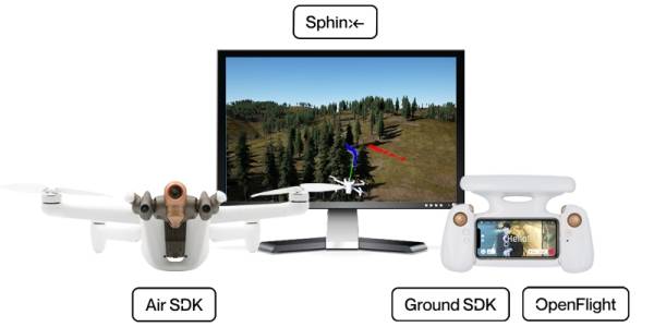
Key features:
- Embed your code on the drone with Air SDK
- Create mobile apps with Ground SDK
- Customize open-source GCS with OpenFlight
- Use state-of-the-art drone simulation tool with Sphinx
- Develop python scripts with Olympe
- Process video and metadata with PDrAW
Parrot Software Development Kit is a set of tools and open-source software for developers. Since the first A.R. Drone, open-source is at the heart of our platforms and developer tools, and Parrot continually contributes to the open-source community.
All our SDK resources are available for free, without registration or tracking, on the Parrot Developer Portal.
Join thousands of developers on our forum and discuss directly with Parrot engineers.
Write code. Build apps. Create Missions. Fly drones!
Air SDK
Run your code on ANAFI Ai
Air SDK provides a breakthrough technological architecture to load and run code directly on ANAFI Ai. Developers can program custom-designed flight missions with access to all drone sensors, connectivity interfaces, and autopilot features.
Air SDK give onboard access to:
- All the sensors (IMU, GPS, TOF) and flight states
- Video streams and metadata from all cameras
- Wi-Fi, 4G, USB communication interfaces
- Depth maps and occupation grids
- Obstacle avoidance trajectory generation
Any developer can:
- Modify the drone state-machine by creating Flight Missions
- Change the guidance mode
- Add onboard Linux processes (such as transferring data on the 4G link or use computer vision)
Air SDK supports C++ or Python programming language. Air SDK comes with a comprehensive installation guide and API documentation. Many sample applications illustrate all the possibilities offered by its unique architecture.


Command and control

Autonomous flights

Occupation grid

Custom flight mission


Camera video feeds

Telemetry

Wifi/4G connectivity

Internal and external storage


Ground SDK
Create powerful mobile application
Ground SDK is a Ground Control Station (GCS) framework for mobile devices (both iOS and Android are supported). It allows any developer to create a mobile application for ANAFI Ai, controlling the drone directly from the mobile device. All the features of the aircraft (control, video, settings) are accessible through an easy-to-use and fully documented API.

Command and control
Occupation grid
Air SDK custom flight mission
Wifi/4G connectivity
Camera video feeds
Telemetry

Remote drone media storage

OpenFlight
Open-source ground control station
For the first time, Parrot is open-sourcing its ground control station application. OpenFlight is the open-source core of our acclaimed FreeFlight 7 application. As a developer, you can focus on adding your own features and will immediately get a professional-looking App ready to be published on the application stores.
OpenFlight contains:
- All the UX of FreeFlight 7
- All the settings interfaces
- The code for real-time 3D visualization of obstacles
- The code for 4G connectivity management
OpenFlight is published under the BSD-3 license with a full installation guide and comprehensive documentation.

Sphinx
3D photorealistic simulation
Parrot Sphinx is a state-of-the-art drone simulation tool. Parrot engineers use it to develop and test all the features of ANAFI Ai.
The general concept is to simulate the real drone firmware, with all its sensors in a visually and physically realistic environment.
Parrot Sphinx allows you to:
- Simulate all camera and sensors
- Simulate depth maps and segmentation images
- Navigate into many realistic 3D scenes
- Connect to different types of remote controller
- Use scripts to control the simulation
- Add pedestrians and vehicles
- Visualize and record flight data
- Configure drone sensors and surrounding physics elements
- Control the real-time factor
Parrot Sphinx is built on cutting-edge industry standard components:
Gazebo, the open-source robotic simulation framework from OSRF.
Unreal Engine, the advanced real-time 3D creation tool from Epic Games.

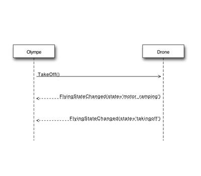
Olympe
Use Python to control ANAFI Ai
Olympe provides a Python controller programming interface for ANAFI Ai. The original purpose of Olympe is to interact with the simulation environment Sphinx. Olympe can also control a physical ANAFI Ai from a remote computer.
Olympe framework allows you to:
- Connect to simulated or physical ANAFI Ai
- Send command messages (piloting, camera orientation, RTH, FlightPlan)
- Start and stop video streaming of all cameras
- Record the video stream and the synced metadata

PDrAW
Advanced media player
PDrAW is an advanced video viewer for ANAFI Ai media. The viewer supports both streamed (RTP/RTSP) and recorded (MP4) videos, on Linux, macOS, Android, and iOS platforms. PDrAW comes as a library (libpdraw), a wrapper library (libpdraw-backend), and a standalone executable (pdraw).
PDrAW also manage video metadata. On ANAFI Ai, both the streamed and the recorded video embed metadata that are publicly accessible and documented, allowing advanced processing of aerial videos.


C.A.D. Models
We make available a 3D model of our drones to integrate into your CAD project for rapid prototyping and accessories integration.
MAVLink and GUTMA compatibility
ANAFI Ai is compatible with the open-source standard MAVLink v1 protocol, allowing for real-time data exchange between the UAV and a control station. ANAFI Ai can be flown manually or using automatic flight planning from MAVLink compatible base station, such as QGroundControl.

QGroundControl interface
ANAFI Ai is compatible with the open-source GUTMA standard protocol for flight data. The Global UTM Association is a consortium of major players in the field of airspace traffic management.
The largest Partner Ecosystem for drones
We keep on expanding our global ecosystem of drone software providers through our SDK Partner Program, offering specialized and unique solutions for the growing and evolving needs of professional users.
Key features
- Leverage our compatible drone softwares ecosystem
- From fleet management to surveying & mapping
- Get the most of your inspection process
Parrot fits any specific business needs
Leverage our compatible drone softwares ecosystem, from fleet management, flight plan and flight logs import, to surveying, mapping, monitoring, and data analysis to get the most of your inspection process.
PIX4D x Parrot
2D/3D modeling applications
A unique suite of mobile, desktop and cloud Photogrammetry applications.

PIX4Dreact

PIX4Dmapper

PIX4Dscan

PIX4Dinspect

PIX4Dcloud
Skyward x Parrot
Integration and training for ANAFI range
Aviation management platform, including airspace, LAANC access, as well as training, hardware, and connectivity for enterprise drone fleet deployments.

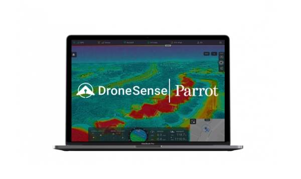
DroneSense x Parrot
Build, manage and scale your unmanned aircraft programs
Public safety UAS teams are able to use the full suite of DroneSense capabilities tailor-made for the needs of first responders with their ANAFI aircraft.
They are part of our Ecosystem
Discover our Partner Program
Expand your drone program capabilities by easily integrating our SDK.


Cybersecurity by Design
Key features:
- Zero data shared without user consent
- FIPS140-2 compliant and CC EAL5+ certified Secure Elements
- Strong authentication for 4G
- Digitally signed pictures
- Transparency and Bug bounty continuous security check
No data shared by default
Parrot collects no data without the consent of the users. The user can decide whether he shares data to Parrot infrastructure or not. Data hosted by Parrot enables the user to synchronize flight data and flight plans between different devices, eases support and allows Parrot to enhance products.
ANAFI Ai is compliant with the European Union General Data Protection Regulation (GDPR) and goes beyond, for example with a 1-Click deletion of all data so that users keep control very easily. It’s a matter of 1-Click in the FreeFlight7 mobile App or in the privacy settings of their Parrot.Cloud account. Thus, users may not only stop sharing data at any time, but they can also ask for data deletion very easily.
When the user consents to share data, data processing is fully transparent and described in the Parrot Privacy Policy.
When ANAFI Ai is connected to the Skycontroller 4 through 4G, Parrot infrastructure is used to pair the drone and the remote controller. If the user is not authenticated with a Parrot.Cloud account, he can still use 4G with a unique temporary account. When using Parrot infrastructure for 4G pairing, video is encrypted with a key negotiated between the drone and remote controller, Parrot has no access to unencrypted videos.
FIPS140-2 compliant and CC EAL5+ certified Secure Element
ANAFI Ai embeds a Wisekey Secure Element which is NIST FIPS140-2 Level 3 compliant and Common Criteria EAL5+ certified. A similar Secure Element is also embedded on the Skycontroller 4.
The Secure Element:
- performs cryptographic operations
- stores and protects sensitive information

It features a ECDSA private key, with P521 domain parameters, unique to each drone. This private key cannot be extracted from the Secure Element. The certificate associated to this key is signed by a certification authority.
The Secure Element protects the integrity of the embedded software, provides a unique identity to the drone for 4G pairing and strong authentication, and features a unique digital signing of the pictures taken by the drone.

4G secure pairing and strong authentication
When a user enables 4G communication, the initial WiFi connection is first used for a secure pairing process. During this process, the user securely proves he is connected to a specific drone. Thanks to ANAFI Ai Secure Element, he can do so without configuring any password inside the drone. Then, Parrot servers register the association between the user and the drone. When Wi-Fi connection between the user and the drone is lost, ANAFI Ai automatically connects in 4G. ANAFI Ai does a strong authentication on Parrot servers, using its private key stored on the Secure Element. Parrot servers look for the associated users and enables pairing between ANAFI Ai and the Skycontroller 4.
With 4G, ANAFI Ai performs a strong authentication to log in to Parrot servers. This strong authentication implies a client certificate and a unique private ANAFI Ai key, stored in the Secure Element.
ANAFI Ai supports TLS, DTLS and SRTP protocols, to protect drone control and video streams to the Skycontroller 4.


Secure initialization and update
The drone’s boot sequence is secured: the system checks that it uses Parrot software and that this software hasn’t been tampered. A security check is performed at each initialization. The update service also controls the digital signature of software updates.
Configuring user keys on the Secure Element
ANAFI Ai users have access to a dedicated operator account of the drone’s Secure Element. This account is used to configure keys specific to the user. Users can configure into the Secure Element the public keys of the flight mission providers they choose to trust. ANAFI Ai will only run flight missions which are numerically signed with these keys. This process prevents an attacker from running malicious flight missions on the drone.
Digitally signed pictures
ANAFI Ai’s Secure Element can digitally sign the pictures taken by the drone. This signature provides a proof that:
- said signed picture has been taken by said drone;
- neither the picture itself nor its metadata have been tempered with (voluntarily or not) – metadata, also known as EXIF and XMP, contain information about the date, time and location of the picture.

In other words, the digital signature secures all data relevant to a picture, including the place where and the time when it was taken, and by which ANAFI Ai drone.
Users as well as partners proposing software solutions exploiting drone photographs can verify the digital signature of ANAFI Ai photos, either using the drone's certificate, or through a public key directory, provided by Parrot.
Transparency and Bug bounty continuous security check
Whenever possible, Parrot uses standard protocol and file formats. There is no obfuscated code, nor hidden features. It allows the user to understand how Parrot products works and check their security. In addition, OpenFlight - the software used to control the drone - is Open Source: then, the users benefit from full control.
Back in April 2021, Parrot has launched a “Bug Bounty” program together with YesWeHack, the first European crowdsourced security platform. Through this partnership, Parrot benefits from YesWeHack's vast community of cybersecurity researchers to identify potential vulnerabilities in its drones, mobile applications and WebServices.
The Bug Bounty program takes place in two phases:
The private programs initially gives exclusive access to selected security researchers and includes future Parrot drone models. The expertise and diverse skills of the researchers will confirm the high level of security of the products before they are marketed, for the greater benefit of Parrot users' security and the protection of their data.
After this first phase in a private Bug Bounty program, and after being commercialized, the products enters a public program. Their security is then scrutinized by the entire YesWeHack community, representing more than 22,000 cybersecurity researchers.

Download the technical documentation