1 - 1 de 13 resultados

DJI AeroScope Sistema de detección de drones DJI en tiempo real

N.º de producto: DJI AEROSCOPE SDD

No disponible en estos momentos

Notificar sobre disponibilidad
Forma de entrega disponible: Ceuta y Melilla

DJI AeroScope Sistema de detección de drones DJI en tiempo real

aeroscopeheader-2880x1440

Sistema de detección de drones DJI en tiempo real


El uso de drones ha crecido exponencialmente en los últimos años.

Naturalmente, hay una creciente preocupación por la seguridad pública, la seguridad del tráfico aéreo y la privacidad.

En respuesta, DJI ha lanzado AeroScope, un sistema de detección de drones especialmente diseñado, que permite a un operador rastrear fácilmente los datos de telemetría de los drones de la marca DJI en el espacio aéreo circundante de hasta 20 km. (12.5 millas).

En efecto, se trata de un sistema de detección del código electrónico del drone o del numero de operador ( Como las matrículas de coches) que se proporciona por los equipos de seguridad del aérea ( AESA ) que seran los datos necesarios para poder proteger de forma rápida y eficaz contra la intrusión de drones.


Al interceptar el enlace de comunicaciones actual entre un drone DJI y su control remoto, AeroScope puede transmitir información de identificación en tiempo real, incluyendo código de serie UAV, marca y modelo, posición UAV, velocidad, latitud y ubicación del controlador de tierra. Esto le permite al operador tomar medidas de mitigación contra la amenaza de los drones y al mismo tiempo enviar equipos de seguridad / aplicación de la ley para aprehender al piloto.


Stockrc es un proveedor certificado de suministro, instalación, servicio y capacitación de DJI AeroScope. Póngase en contacto con nosotros hoy para averiguar cómo AeroScope puede ayudarlo a reducir significativamente la amenaza de la actividad de drones ilegales.

Frequently asked questions

What circumstances can DJI AeroScope be used?

DJI AeroScope fixed and portable systems can be deployed in any areas at risk of illegal drone activity. It will ease drone safety concerns at various locations including airports, military facilities, stadiums, festivals and prisons to name but a few.

Does the device have to be connected to the Internet in order to work?

Fixed Yes – Requires Ethernet or WiFi dongle connection to enable the AeroScope system to send data back to the terminal.

Portable No – Internet connection is not required.

Do I need wi-fi or GPS connection to run the device?
No. AeroScope is fully functional as a drone identification and tracking solution without any wifi or GPS connection required. However, the fixed AeroScope system needs a wired internet connection to transmit back to terminal.

What data can we see on the device?
Drone serial number, direction, speed, altitude, lat/long location, home-point, pilot location and model name (Phantom, Mavic, etc.). There are also two optional text fields that pilots can fill with text of up to 100 characters, such as a license number or name and contact information.

Can the user decide which data to display?
The basic information used to locate and identify the type of drone cannot be turned off. Two text fields that will eventually allow the user to broadcast personal information about their identity and their mission, are optional.

Will the user be notified when his/her drone is being tracked while flying?
No. There is no way for the system to determine whether any of the information it transmits is being received.

Who has access to this data? Who has access to any stored data?
The owner of the AeroScope receiver, typically a public safety agency or facility such as an airport.

Will it work in any weather condition?
The fixed version has IP67 protection which makes it suitable for outdoor use, in temperatures from -40 C to 55 C. The portable version’s case is provided by a third party and is waterproof.

Can DJI AeroScope identify the pilot location?
Yes. This will allow the authorities to find the pilot and ask questions about the operation. At first, this location will be represented by the home takeoff point, but in later versions will provide a live updated track based on pilot GPS location obtained from the mobile device paired to the RC and used to fly.


USE CASES :


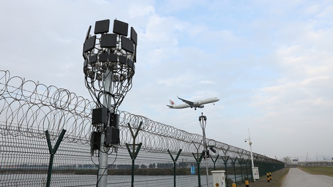
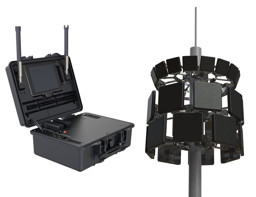
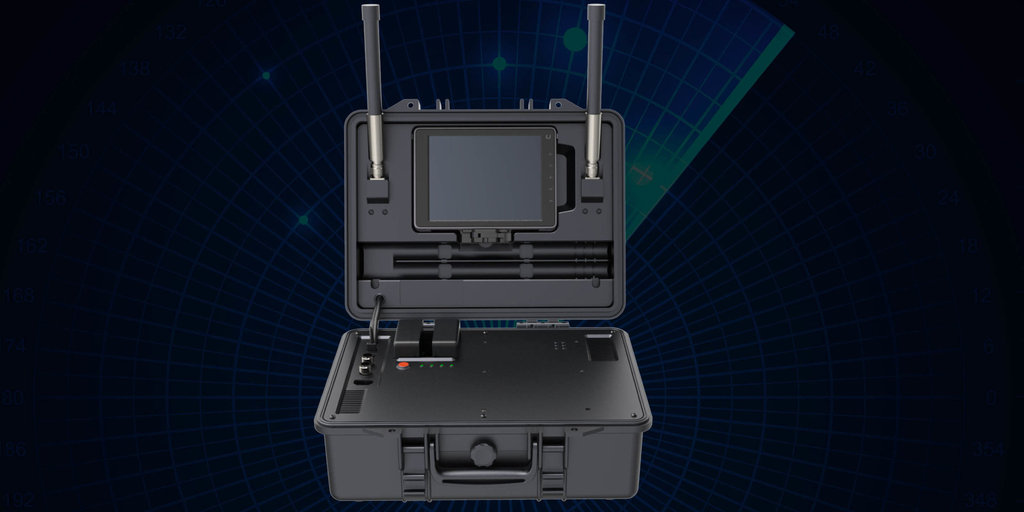
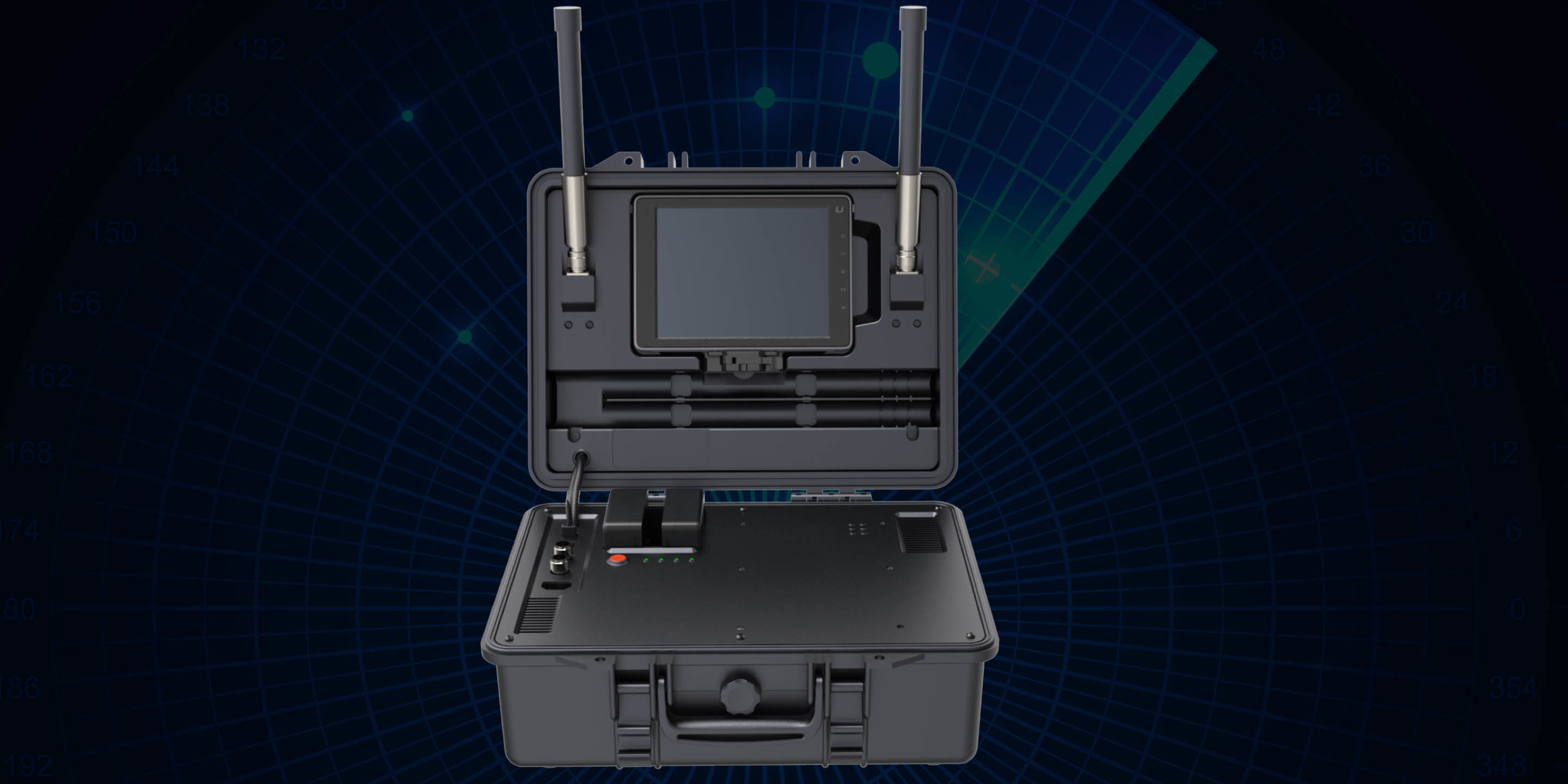
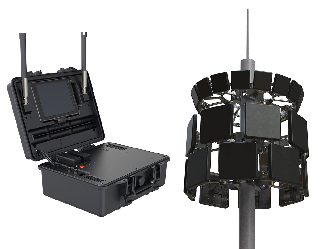
Fixed & Portable Solutions

Fixed and portable solutions available

IP65 rated for all weather operation

Lightning protected

Extreme temperature and humidity operation

Flexible for different coverage and different server deployment

Turnkey – installation, configuration, training and maintenance solution
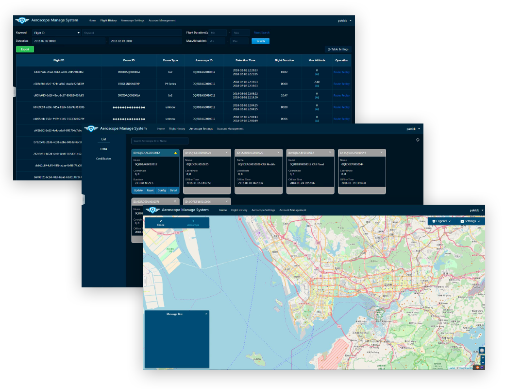
aeroscopeversions

Software Interface

  • Real-time monitoring
  • Flight historical data retrieve and playback
  • Escalating stage alarms to align with your security procedures

Extensive mapping and data logging options

  • Vastly improves site security against drone intrusion

Reduce man-hours needed for drone surveillance

  • Provides accurate data to act upon quickly and effectively

aeroscopescreenshots

Drone detection is the hottest topic in the industry at this moment in time. The use of drones has grown exponentially in recent years. With the increasing number of drones taking to the skies, naturally, there is a growing concern for public safety, air traffic safety and privacy. During this 30 minute webinar, the Managing Director at Stockrc will discuss the risks and how drone detection systems can be used to protect from the threat of illegal drone activity.

What You'll Learn


The increasing use of commercial and hobbyist drones and the threats that they pose. The current drone detection systems available and how they work. An overview of the new DJI AeroScope system. The exact real-time data you can acquire with the use of a drone detection system such as AeroScope. How drone detection data can be used to apprehend and prosecute illegal drone operators.

aeroscopeairport

Examine esta categoría: DJI Enterprise
1 - 1 de 13 resultados